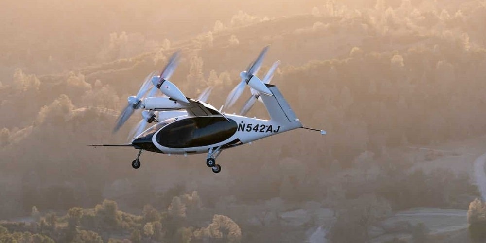
Joby Aviation and NASA are kicking off a two-week test campaign to study the acoustic signature of Joby’s all-electric passenger aircraft. These tests come as…
Where classic surveying reaches its limits, the 3D photogrammetry application Agisoft Metashape Pro is being used, often in a combination with so-called ‘drones’ or Unmanned…
The leaders of organizations rely on having the resources and intelligence that guide them toward making the right decisions at the right times. Accurate information…
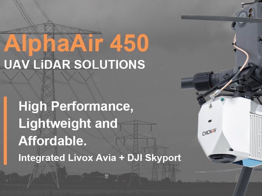
The lightest, advanced accurate, and cost-effective UAV LiDAR system in its class. CHC Navigation (CHCNAV) announced the release of the AlphaAir 450 (AA450) LiDAR system.…
As a professional IT solutions provider, Schneider Digital is specialized in the development and manufacturing of stereoscopic display systems, as well as the production of…
Remote sensing and Geographic Information System (GIS) technologies are commonly used for real-time analysis and forecasts of weather, floods, and monitoring crop area sown, lost,…
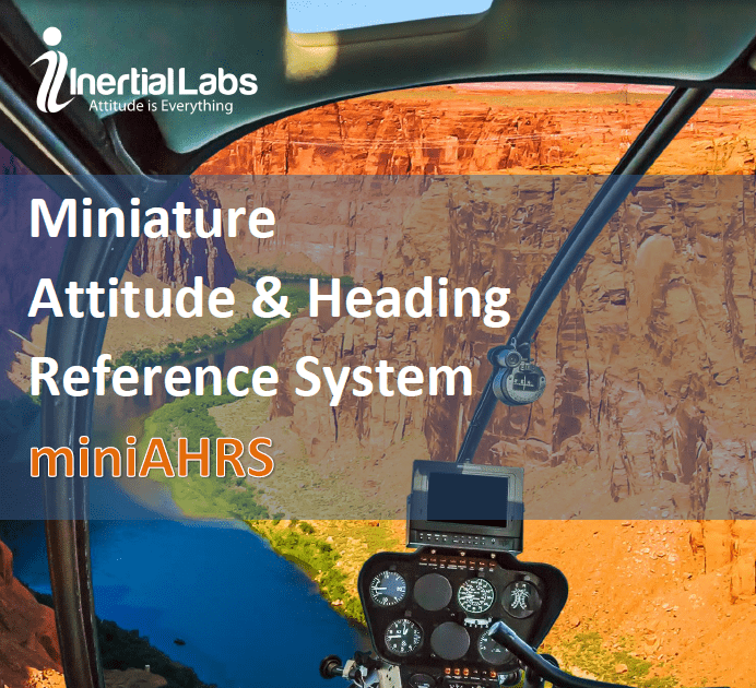
All new MiniAHRS delivers a cost-effective and high-performance strapdown system The new Inertial Labs MiniAHRS utilizes 3-axes each of precision accelerometers, magnetometers and gyroscopes to…
While digital infrastructure might not be the cure to COVID-19, the disease caused by the coronavirus, it is undoubtedly helping the world cope in many…
Commercial UAV Expo Americas is a re-imagined virtual event where the commercial drone community will gather to learn, connect, and drive the industry forward to…