Virtual Surveyor has added Local Coordinate System functionality to the 10.2 release of its smart drone surveying package. This means users can easily define a…
GeoWGS84 Corp today announced the successful acquisition of the full LizardTech suite of geospatial software products from Extensis (Monotype). This acquisition includes all rights to…
Phase One, a global leader in high-end imaging solutions, proudly announces a series of groundbreaking innovations debuting at Intergeo 2025. With a strong focus on enabling geospatial professionals to…
Swift’s open, receiver-agnostic ecosystem removes integration barriers, reduces costs, and speeds time-to-market for industries requiring precise positioning. Swift Navigation, a leader in precise positioning technology,…
Pix4D and SPH Engineering’s UgCS have announced new strategic partnership designed “to empower drone professionals with an integration of precise flight planning and high-end photogrammetry processing.” In…
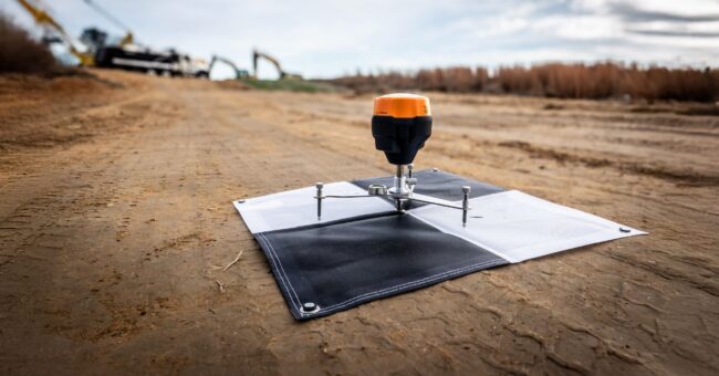
Emlid adds high precision to WingtraGROUND, a new kit for survey-grade aerial data capture with the WingtraONE Gen II—VTOL drone widely regarded as the industry…
DJI introduces the DJI Matrice 4 Series as the company’s new compact flagship enterprise drone series. Launching with the Matrice 4T and Matrice 4E, these…
Viavi Solutions Inc. (VIAVI) (NASDAQ: VIAV) announced that it has signed a definitive agreement to acquire Inertial Labs, Inc. for initial consideration of $150 million…
YellowScan, a prominent player and innovator in the field of LiDAR solutions for unmanned applications, has unveiled its latest bathymetric system, the YellowScan Navigator, during…