You can find the latest breaking news about Surveying, Mapping, Lidar, and Photogrammetry for the geospatial community.
How CGIS Qatar Built a Vectorized 3D City Model of…
By
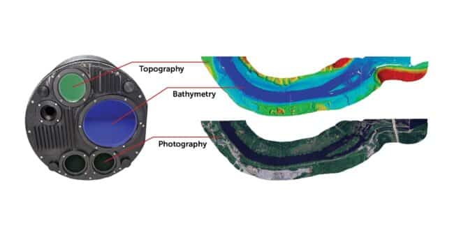
The Centre for Geographic Information Systems (CGIS), the official geospatial agency of the State of Qatar, has taken a pioneering step in aerial imaging and 3D…
< 1 min read