
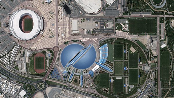
The Centre for Geographic Information Systems (CGIS), the official geospatial agency of the State of Qatar, has taken a pioneering step in aerial imaging and 3D city modeling. CGIS has successfully delivered Qatar’s first advanced vectorized watertight 3D city model of Doha — a milestone achievement in the nation’s digital transformation journey.
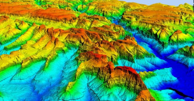
From acquiring data with the UltraCam Osprey 4.1 and processing imagery with Vexcel’s UltraMap software to generating high-quality watertight LOD2 and LOD3 3D models using sophisticated RhinoTerrain and DAT/EM solutions – the project highlights how cutting-edge technology and collaboration can shape the future of smart cities.
CGIS’s initiative supports urban planning, infrastructure management, and digital twin development, while also advancing disaster response and spatial analysis capabilities through an Esri-based custom image viewer.
Want to see how a vectorized 3D city model comes to life?
Explore the full journey in our case study.
https://www.vexcel-imaging.com/2025_CGIS_CaseStudy_3DCityModel_Vexcel.pdf