Hydrus AUV Reveals Significant Coral Loss at One of the World’s Southernmost Reefs

Advanced Navigation, in collaboration with marine consultancy O2 Marine, has conducted a detailed survey of Hall Bank, a nearshore reef off Fremantle in southwest Australia (32°S), using the Hydrus micro hovering autonomous underwater vehicle (AUV). The survey uncovered severe coral bleaching and fragmentation in one of the southernmost coral reef systems globally.
By capturing geo-referenced high-resolution imagery and 4K video, Hydrus enabled the generation of a 3D digital twin of the reef’s seafloor. The resulting model revealed widespread coral deterioration, with sections of pale and lifeless coral colonies—highlighting the scale of an often-overlooked ecological crisis.
This development follows the mass bleaching events reported in March 2025 at both the Great Barrier Reef and Ningaloo Reef, attributed to a marine heatwave that raised sea surface temperatures by up to 4°C above seasonal norms.
“To truly understand the extent of coral bleaching, we need high-resolution, spatially accurate data that captures both the scale and the fine detail of change beneath the surface,”
said Claudio Del Deo, Co-Managing Director at O2 Marine.
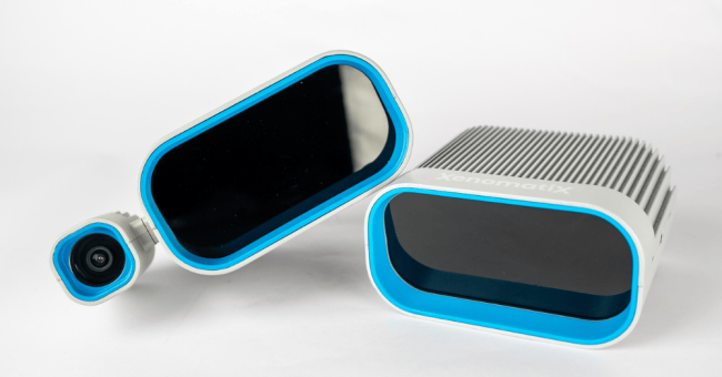
Hydrus’s deployment involved three units performing coordinated transects and lawnmower survey patterns, enabling overlapping, high-resolution spatial coverage. This approach ensured systematic and repeatable data collection across the reef.
“Unlike traditional underwater vehicles, Hydrus’s compact design, fleet deployability, and ability to gather professional-grade data allow us to monitor reefs at a scale and frequency previously unattainable,”
added Del Deo, emphasizing the system’s role in improving conservation strategies and long-term reef monitoring.
Hall Bank is recognized as a valuable example of high-latitude reef resilience, supporting tropical, subtropical, and temperate coral species in cold, turbid waters. This makes it a critical natural lab for studying climate-driven species range shifts and reef adaptation.
“Collecting high-quality ocean data has traditionally been slow, costly, and resource-intensive. That simply doesn’t scale, especially when time-sensitive data is needed across large or remote areas,”
noted Alec McGregor, Senior AI Engineer at Advanced Navigation.
“Hydrus changes the equation. At just 7kg, it can be deployed by a single person, without support vessels or complex logistics. This mission is a powerful example of what’s possible when cutting-edge robotics meets urgent environmental challenges.”
Expanding the Underwater Mapping Frontier
The mission also aligns with global initiatives such as Seabed 2030 and the United Nations Decade of Ocean Science, supporting broader efforts to map the remaining 73.9% of unexplored ocean floors. Hydrus has already been used in previous deep-sea discoveries, including the 2024 identification of a 64-meter shipwreck in the Indian Ocean. The high-resolution model produced during that mission is now part of the Western Australian Museum’s public archive.
As climate threats intensify and underwater ecosystems change rapidly, technologies like Hydrus are becoming central to marine data collection, environmental monitoring, and adaptive conservation.


