Canada marks 10 years of National Elevation Data Strategy
Canada’s National Elevation Data Strategy is celebrating a decade of transforming how businesses, governments and communities access and use high-resolution elevation data, a critical foundation for climate resilience, infrastructure development…
2 min read
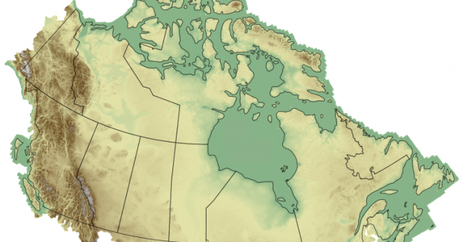
Canada’s National Elevation Data Strategy is celebrating a decade of transforming how businesses, governments and communities access and use high-resolution elevation data, a critical foundation for climate resilience, infrastructure development and resource management.
Launched in 2015 and led by Natural Resources Canada (NRCan), the initiative has rapidly expanded the availability of precise 3D mapping information across the country. The programme is built on deep collaboration with provincial and territorial governments, Indigenous communities, municipalities and other federal departments. NRCan emphasizes that accurate elevation data underpins billions of dollars in decisions every year, influencing where infrastructure is built, how natural resources are managed and what protective measures are needed as Canada adapts to a changing climate.
Accelerating access and data quality through collaboration
The strategy has focused on expanding high-resolution elevation coverage across the country and making the data easier to access and use. By deploying advanced airborne Lidar and satellite technologies, NRCan and its partners have strengthened the national geospatial infrastructure that supports decisions from emergency response to land development. Collaboration among federal, provincial, territorial and municipal partners ensures that existing datasets are put to work and that new data investments benefit all jurisdictions. To keep quality consistent, Canada has also introduced a national airborne Lidar standard, replacing the older federal guideline and creating one clear benchmark for topographic and topo-bathymetric data.
Ten years of progress have resulted in national products now embedded in everyday planning and monitoring. The High Resolution Digital Elevation Model offers detailed topography at one- to two-metre resolution, while the HRDEM Mosaic provides a seamless, user-friendly way to visualize data from across the country. In regions where Lidar coverage is still being built out, the Medium Resolution Digital Elevation Model fills the gap with a complete national picture at 30-metre resolution. Lidar Point Clouds can be downloaded directly to support 3D analysis in common GIS tools, and automatically extracted building footprints are adding valuable intelligence for insurers, planners and asset managers.
Growing economic relevance of elevation data
The results of the strategy are already significant. More than two million square kilometres of airborne Lidar have been integrated, covering nearly all of Canada’s largest cities and the vast majority of the Canadian population. In the North, 4.5 million square kilometres of satellite-derived elevation data have been processed to align with Canadian standards, strengthening planning capacity in remote and rapidly changing landscapes. Over 13.6 million building footprints have been derived from Lidar, and more than 364,000 square kilometres of Lidar point clouds are publicly available – supporting faster project planning, better risk assessments and the expansion of data-driven innovation across the country.
With another decade underway, the strategy is ensuring Canada remains a leader in digital mapping and spatial insight. Its continued development – built on strong collaboration between levels of government and communities – is boosting productivity and resilience across multiple sectors, underscoring the growing economic importance of accurate elevation data.