Forestry 4.0: How the “Digital Twin” of the Forest Is Created
“A practical report on photogrammetry, stereoscopy and AI” The sustainable management of forest areas is undergoing a paradigm shift. Where a look at the forest management plan used to be…
6 min read
“A practical report on photogrammetry, stereoscopy and AI”
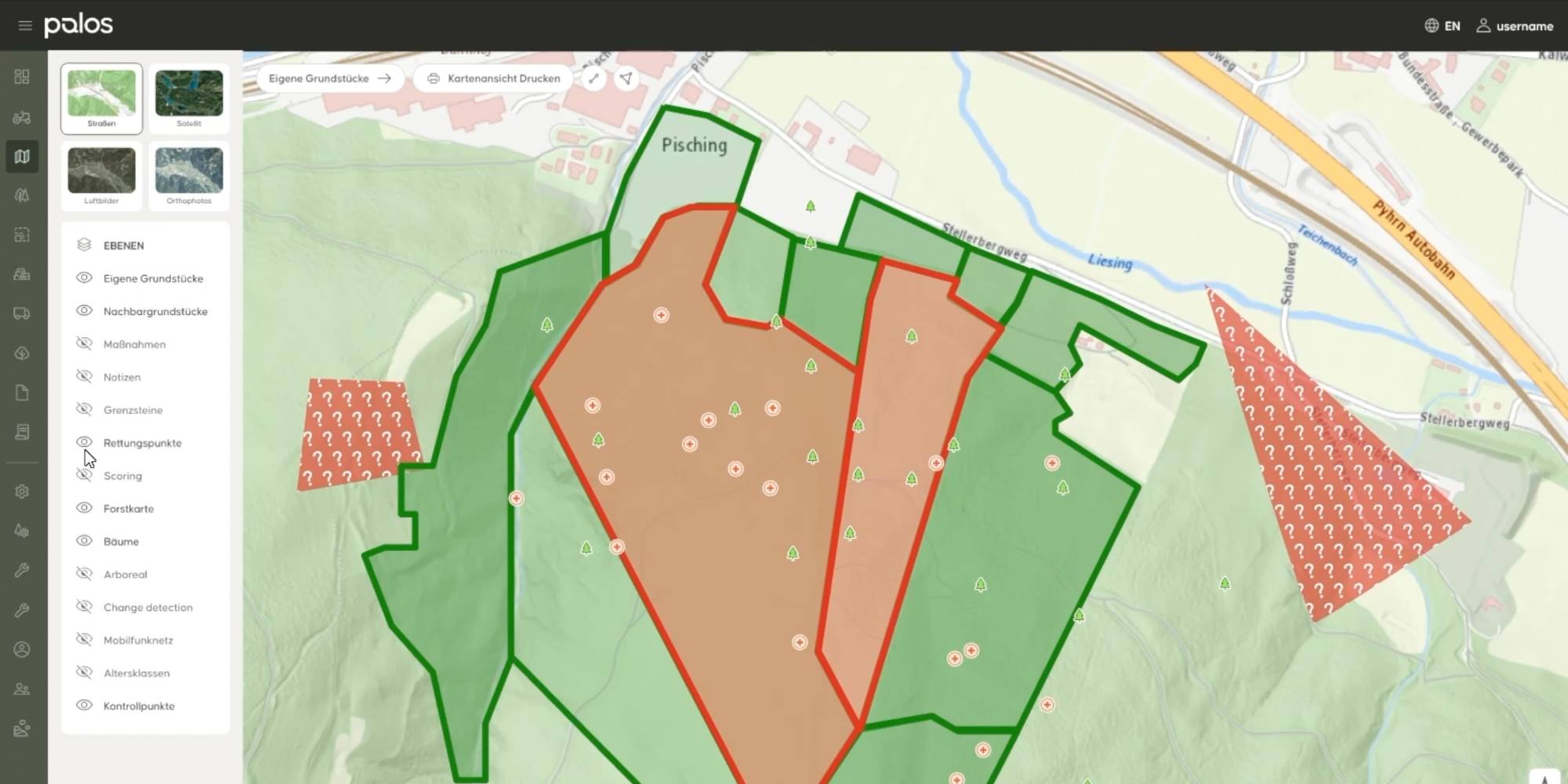
The sustainable management of forest areas is undergoing a paradigm shift. Where a look at the forest management plan used to be sufficient, centimeter-level accuracy, response speed and artificial intelligence now determine efficiency, transparency and yield. The Austrian company Palos, a forest management platform based in Salzburg, together with the surveying experts at FMM (Forest Mapping Management GmbH), demonstrates how a seamless digital process chain is created: from demanding data acquisition over the Alps to high-end analysis on the 3D PluraView monitor from Schneider Digital.
The location is strategically chosen: in the heart of Salzburg, in the Alps and in immediate proximity to Germany, a team of geoinformatics specialists and forestry experts is at work. The location is more than postcard scenery; it is an operational necessity for Martin Ulz, Head of Photogrammetry at FMM. “We are very close to the Alps and centrally located within Austria,” Ulz explains. The decisive factor in modern aerial surveying is time. In the Alps, weather windows with cloud-free visibility often open only briefly. “We are very, very fast when it comes to making use of these weather gaps,” Ulz adds. This agility sets the service provider apart from less flexible market players.
Phase 1: Precise raw data from the air
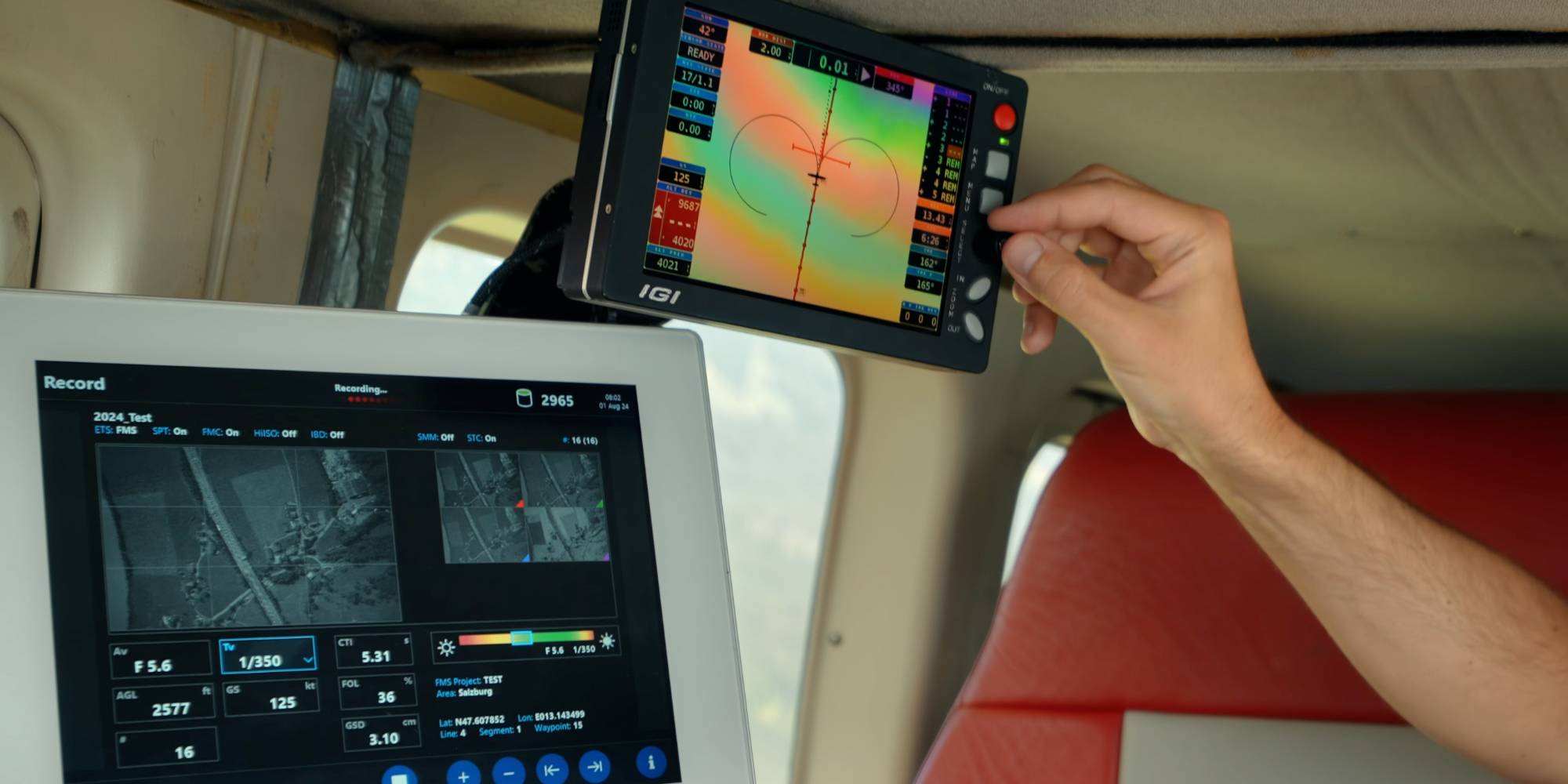
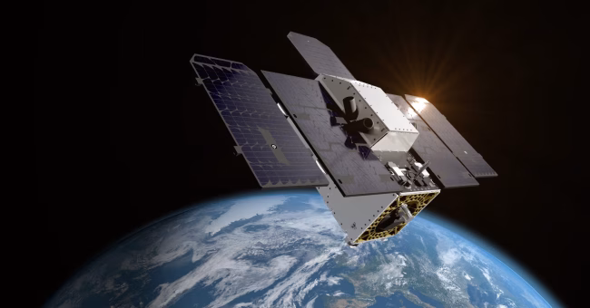
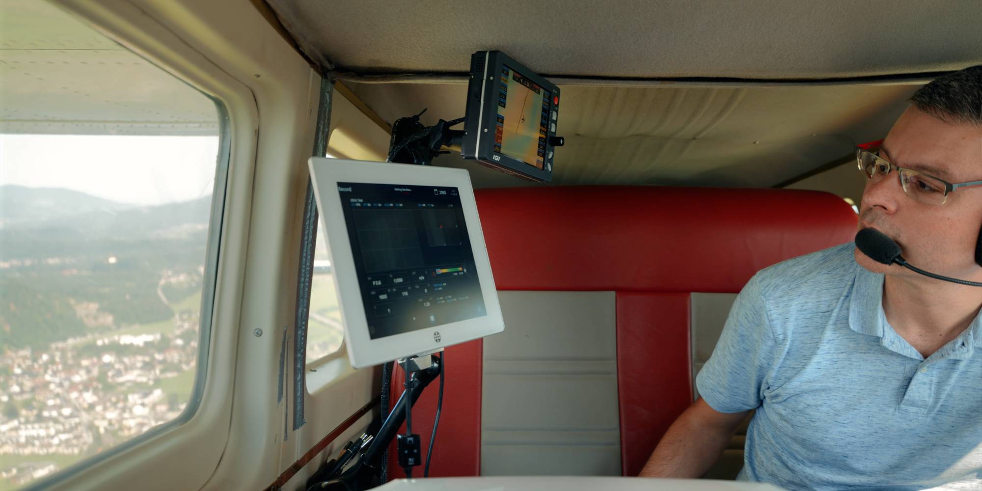
The digitalization process begins long before the first mouse click at the computer. A precisely planned aerial image acquisition day starts in the office with the exact definition of the flight lines. The aim is not only to photograph the Earth’s surface, but to capture it with geometric precision.
The technical equipment on board the aircraft is correspondingly powerful. The data is stored on special Data Units that enable the storage of more than 5,000 high-resolution aerial images. Yet the image alone has little value without its exact position. “For every camera trigger point, we know the exact coordinates to an accuracy of about 10 centimeters,” Ulz emphasizes. This high positional accuracy of the sensors forms the foundation for all subsequent process steps. Without precision at the source, a reliable inventory analysis of the forest would not be possible.
Phase 2: The technical core – Stereoscopy as the key to 3D coordinates
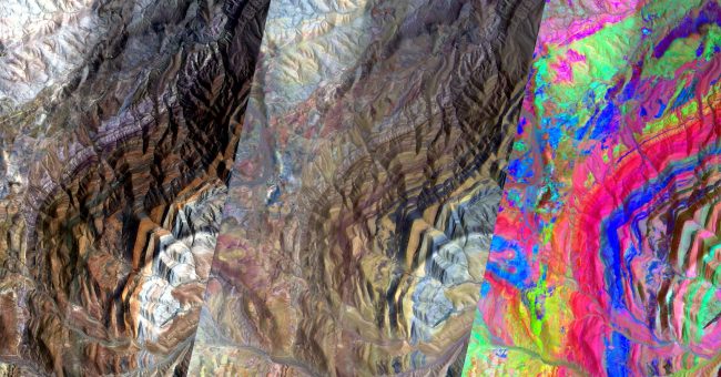
In the office, the raw data is transformed into usable information. Martin Ulz clearly summarizes the methodological requirements: “Stereoscopic analysis is the only way to actually measure coordinates from aerial survey images.”
He clearly differentiates the method from simpler approaches: “In the monoscopic domain [2D viewing], this would not be possible because we always need a second image pair for the spatial representation of the coordinates.” Using the photogrammetric method of 3D forward intersection, digital surface models are derived from the overlapping images. This allows every position on the Earth’s surface to be represented three-dimensionally, documented and, above all, precisely determined in height.
Phase 3: Workstation of the future – High-tech visualization with 3D PluraView
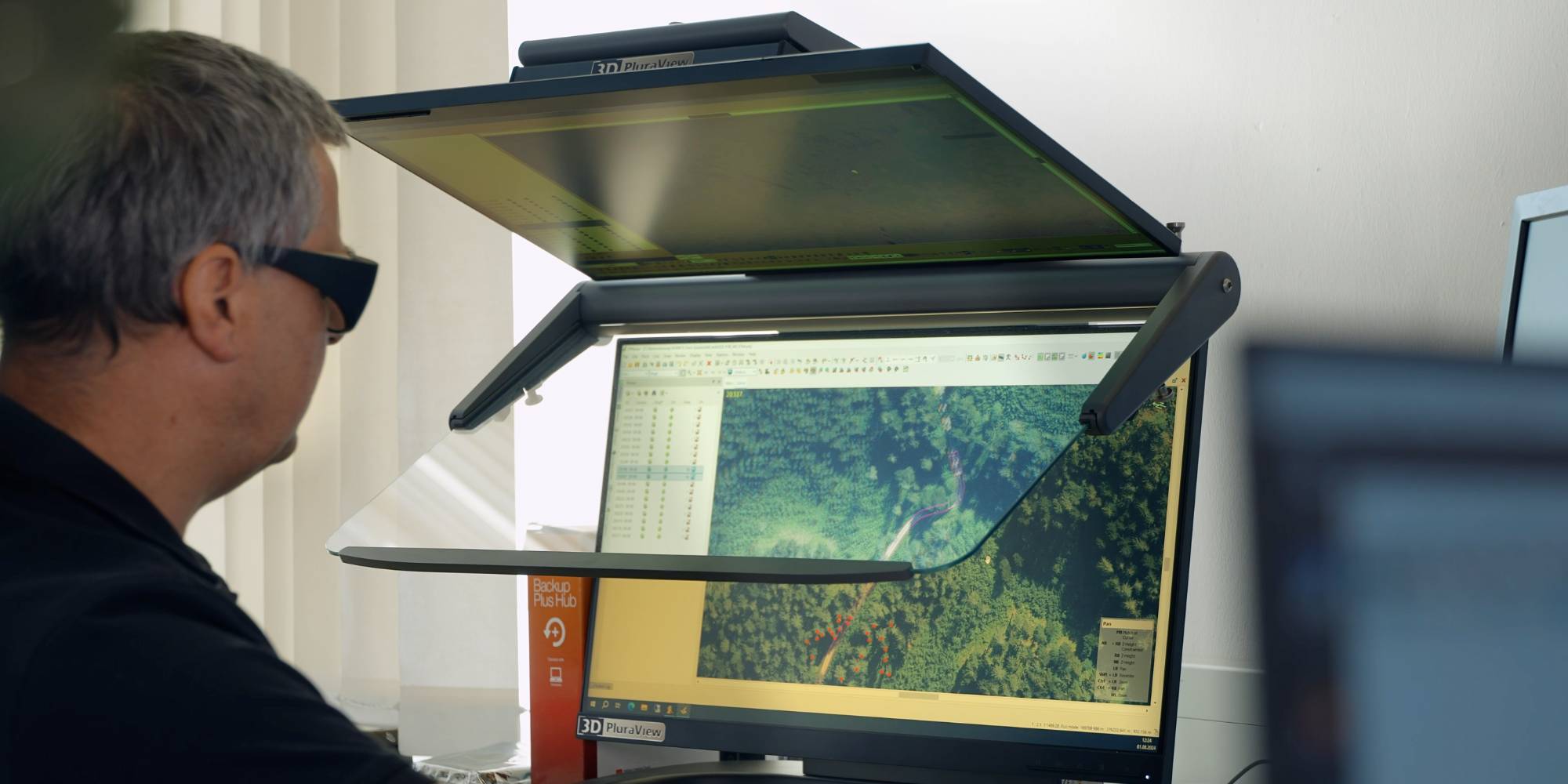
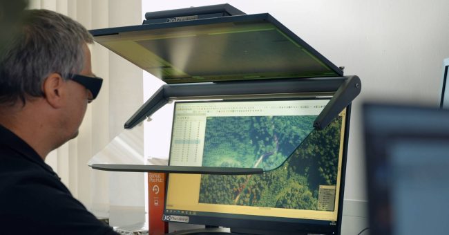
The extensive data volumes ultimately arrive at Bernhard Brunner’s workstation. The graduate surveying engineer (Graz University of Technology, specializing in photogrammetry and remote sensing) is responsible for digital aerial image analysis. His requirements for image quality are high: “You can recognize details on the ground that are approximately 10 centimeters in size.”
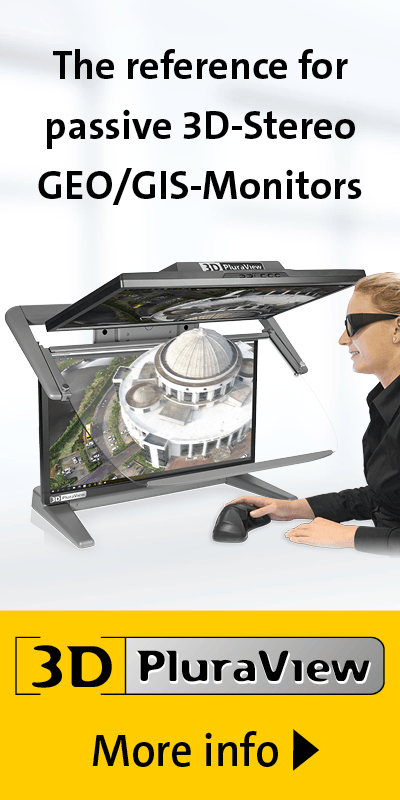
To interpret these details reliably – such as tree species, treetop conditions or the state of forest roads – the company consistently relies on hardware from Schneider Digital. For years, the 3D PluraView monitor family has been the central tool in the evaluation process.
“In principle, we have been working with the PluraView stereo family for several years and have always come back to it because it is the best solution for us.” – Bernhard Brunner, Palos
The decision in favor of this hardware is based primarily on ergonomics and display quality. Forest mapping is visually demanding. Projects range from short-term analyses to multi-day evaluation tasks. Schneider Digital’s passive stereo monitors provide a flicker-free, daylight-suitable 3D image that enables Brunner to immerse himself deeply in the forest structure without quickly becoming fatigued. Only this immersive representation makes it possible to reliably classify complex structures in dense vegetation.
Phase 4: Symbiosis of human expertise and AI – The “human-in-the-loop” principle
A particularly exciting aspect of the report is the further development of work processes. Palos no longer uses high-end visualization only for classical map production, but also to generate high-quality training data for artificial intelligence.
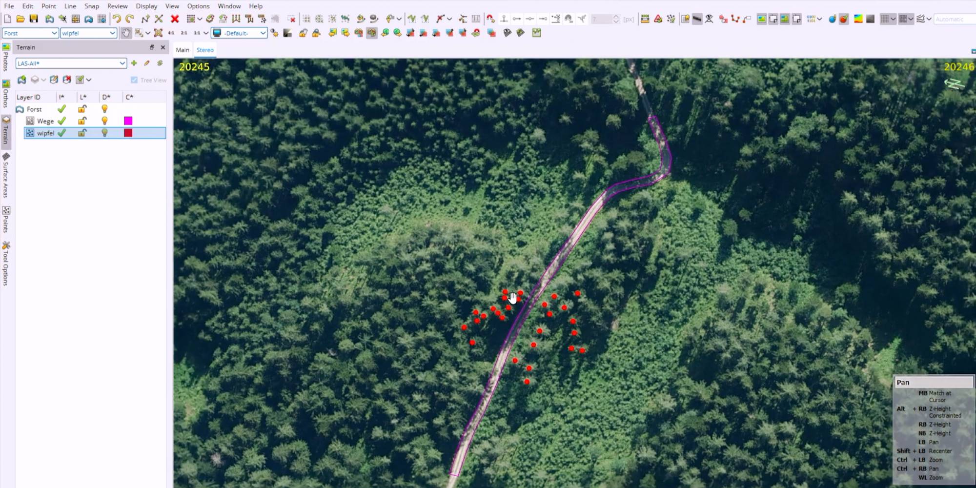
“We can perform stereoscopic analyses of road edges and treetops, which can then be used to train an AI system,” Brunner explains. This is where the circle closes:
Thanks to 3D PluraView, the human expert recognizes complex relationships, for example where a road ends and where the undergrowth begins.
He marks this information as “ground truth”.
The AI learns from this high-quality data to “understand” the forest independently.
This improves automated analyses and enables precise recommendations for harvesting, maintenance or reforestation to be provided to forestry customers more quickly. The quality of AI depends directly on the quality of the training data – and this is safeguarded by the stereoscopic working environment.
Phase 5: From data provider to solution provider
For Palos, the end product is more than an orthophoto or a “true orthophoto”. The real added value arises from its integration into a proprietary forest management software. The photogrammetrically generated data forms the backbone of a digital administration solution. “What we then integrate into the software, the entire forest management behind it, delivers the corresponding added value,” says Ulz.
Outlook: Digitalization of the forest with global ambitions
What was developed as a solution for the specific and demanding conditions of the Austrian and German markets has international potential. Software and processes are to be rolled out globally in the future. “The goal for the coming years is to realize this globally as well,” concludes Ulz. With the combination of surveying expertise close to the Alps, modern 3D hardware from Schneider Digital and AI-supported software, the path is paved for the digital forest of the future.
Summary of technical highlights
| Technology aspect | Detail / Specification |
| Data acquisition | Specialized aircraft, use of short-term weather windows (Alpine region) |
| Sensor technology & storage | Data Units for >5,000 high-resolution aerial images; trigger accuracy approx. 10 cm |
| Evaluation method | Stereoscopy (mandatory for 3D coordinates), 3D forward intersection |
| Visualization | 3D PluraView (Schneider Digital): flicker-free, passive stereo, suitable for continuous use |
| Detail recognition | Ground resolution down to 10 cm (forest road edges, treetops recognizable) |
| Innovation | AI training data through manual 3D evaluation |
| Software | Integration of geodata into specialized forest management software |
Further information: www.schneider-digital.com
Schneider Digital – The Company
Schneider Digital is a globally active full-service solution provider for professional 3D stereo, 4K/8K and VR/AR hardware. Based on 25 years of industry and product experience, as well as excellent relationships with leading manufacturers, Schneider Digital offers innovative, mature professional hardware products and customized complete solutions for professional use. Qualified consulting and dedicated after-sales service are the company’s own standard.
The Schneider Digital product portfolio includes professional hardware solutions for a wide range of requirements: from high-resolution 4K/8K applications through to multi-display walls. Schneider Digital is the manufacturer of its own powerwall solution, Laser smartVR-Wall, as well as the passive stereo monitor 3D PluraView. Performance workstations and professional graphics cards from AMD and NVIDIA, along with innovative hardware peripherals (tracking, input devices, etc.), complete the portfolio. Many products are kept in stock, ensuring fast availability and rapid project implementation.
Schneider Digital is an authorized service distributor for AMD FirePRO/Radeon Pro, PNY/NVIDIA Quadro, 3Dconnexion, Stealth Int., Planar and EIZO. Schneider Digital products are used primarily in graphics-intensive computer applications such as CAD/CAM/CAE, FEM, CFD, simulation, GIS, architecture, medicine and research, film, TV, animation, digital imaging and AI.
Further information is available at www.schneider-digital.com and www.PluraView.com.