
Latitude Spatial has become the first in the world to put Vexcel Imaging’s UltraCam Merlin 5.0 into commercial operation. This milestone marks a confident entrance into the geospatial arena for the company – a new player backed by decades of expertise – and signals its ambition from day one.
Despite being a new brand, Latitude Spatial is founded on deep experience in aerial mapping and photogrammetry. The team previously operated under the HyVista name, building a strong reputation for high-quality UltraCam workflows and reliable data delivery. Now, with a renewed structure and identity, Latitude Spatial is accelerating innovation and responsiveness in the Australian market. By combining long-standing technical knowhow with the latest in large-format imaging technology, the company positions itself to meet rising expectations for accuracy, efficiency and nationwide coverage – a fresh start backed by proven experience in the air.
Peter Cocks, CEO of Latitude Spatial, stated: “We’re proud to be the inaugural customer of Vexcel’s new flagship camera system, the UltraCam Merlin 5.0. Backed by over 30 years of innovation from the global leader in aerial camera technology, this system represents the very latest in high-performance geospatial imaging. For our clients, it delivers not only the world’s best aerial imagery but also significant efficiencies in capture time and cost. In a country as vast as Australia, the ability to map large areas with unmatched accuracy, speed and image quality is truly game-changing. With the Merlin 5.0 at the heart of our operations, we’re excited to introduce Latitude Spatial to the Australian market, setting a new benchmark for aerial mapping services.
While hyperspectral imaging expertise remains available through HyVista, Latitude Spatial will focus on expanding its presence in the photogrammetric imaging sector, leveraging the UltraCam Merlin 5.0 to deliver high-resolution aerial data products across infrastructure, environmental, and resource applications.
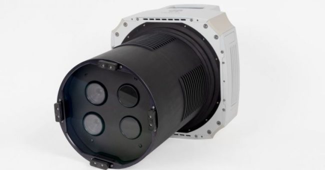
The UltraCam Merlin 5.0 introduces a new level of capability for nadir photogrammetric mapping. Its camera architecture integrates Sony’s latest RGB Bayer pattern CMOS sensor (IMX811) with a dedicated nadir cone assembly, producing distortion-controlled imagery without the need for re-sampling. To support different mission profiles, operators can choose from three interchangeable lens configurations, enabling them to adapt the 37,500 × 19,000-pixel footprint to varying altitudes, airspace conditions, and required ground resolutions.
“We are delighted to see Latitude Spatial lead the way with the UltraCam Merlin 5.0,” commented Alexander Wiechert, CEO of Vexcel Imaging. “Their decision reflects a strong, industry-wide push for solutions that combine operational efficiency, range and flexibility in the air, and uncompromising image quality on the ground.”
The UltraCam Merlin 5.0 is fully integrated with UltraMap’s True Pixel Processing (TPP) workflow. This includes Adaptive Motion Compensation (AMC), which dynamically analyses scene characteristics and corrects motion blur from multiple directions. As a result, the system delivers sharp and accurate imagery, along with reliable derivatives such as orthophotos, elevation models and AI-supported feature extraction. The workflow is designed to scale efficiently, whether projects cover a small area of interest or a continent-wide mapping programme.
In 2025, Vexcel Imaging became the first aerial camera manufacturer to adopt Sony’s new IMX811 sensor – a 247-megapixel CMOS with a 2.81µm pixel size – across three UltraCam systems introduced in the same year. The UltraCam Osprey 4.2 debuted in the spring, followed by the UltraCam Merlin 5.0 and UltraCam Dragon 4.2. This swift rollout highlights Vexcel’s commitment to combining the latest sensor advancements with proven optics, mechanics, and end-to-end processing software, delivering tangible improvements in efficiency, precision, and scalability for aerial mapping and reality capture projects.